


BISHOP Voting District, Effingham County, Illinois
About
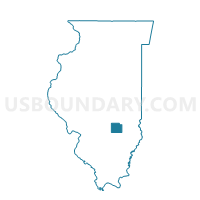
Outline

Summary
| Unique Area Identifier | 570814 |
| Name | BISHOP Voting District |
| County | Effingham County |
| State | Illinois |
| Area (square miles) | 34.94 |
| Land Area (square miles) | 34.94 |
| Water Area (square miles) | 0.00 |
| % of Land Area | 100.00 |
| % of Water Area | 0.00 |
| Latitude of the Internal Point | 39.04539560 |
| Longtitude of the Internal Point | -88.41479020 |
Maps


Graphs
Select a template below for downloading or customizing gragh for BISHOP Voting District, Effingham County, Illinois


Neighbors
Neighoring Voting District (by Name) Neighboring Voting District on the Map
- GROVE Voting District, Jasper County, IL
- LUCAS Voting District, Effingham County, IL
- NORTH MUDDY 1 Voting District, Jasper County, IL
- ST FRANCIS 1 Voting District, Effingham County, IL
- ST FRANCIS 2 Voting District, Effingham County, IL
- TEUTOPOLIS 2 Voting District, Effingham County, IL
- UNION Voting District, Effingham County, IL
- WATSON 1 Voting District, Effingham County, IL
- WATSON 3 Voting District, Effingham County, IL
Top 10 Neighboring County Subdivision (by Population) Neighboring County Subdivision on the Map
- Watson township, Effingham County, IL (3,193)
- Teutopolis township, Effingham County, IL (2,605)
- Bishop township, Effingham County, IL (1,408)
- St. Francis township, Effingham County, IL (1,213)
- North Muddy township, Jasper County, IL (777)
- Union township, Effingham County, IL (742)
- Grove township, Jasper County, IL (618)
- Lucas township, Effingham County, IL (495)
Top 10 Neighboring Place (by Population) Neighboring Place on the Map
Top 10 Neighboring Unified School District (by Population) Neighboring Unified School District on the Map
- Jasper County Community Unit School District 1, IL (9,346)
- Teutopolis Community Unit School District 50, IL (5,674)
- Dieterich Community Unit School District 30, IL (2,307)
Top 10 Neighboring State Legislative District Lower Chamber (by Population) Neighboring State Legislative District Lower Chamber on the Map
Top 10 Neighboring State Legislative District Upper Chamber (by Population) Neighboring State Legislative District Upper Chamber on the Map
Top 10 Neighboring 111th Congressional District (by Population) Neighboring 111th Congressional District on the Map
Top 10 Neighboring Census Tract (by Population) Neighboring Census Tract on the Map
- Census Tract 9505, Effingham County, IL (4,272)
- Census Tract 9775, Jasper County, IL (4,003)
- Census Tract 9501, Effingham County, IL (3,767)
- Census Tract 9773, Jasper County, IL (2,799)